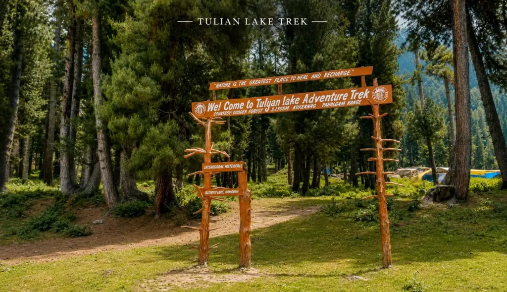
Tulian Lake Trek From Pahlagam
The Figure-Eight Lake at 12,000 Feet
Tulian Lake Trek From Pahalgam Highlights
- Trek Name: Tulian Lake Trek (also called Tulian Valley Trek)
- Trek Duration: 5 days (including drive days)
- Distance : 26 km on trail
- Highest Altitude: 3,685 m / 12,087 ft (Tulian Lake)
- Permit required: No separate trekking permit required
- Location: Kashmir
- Suitable for: 12- 60 years
- Trek Difficulty: Easy to Moderate
- Starting Point: Ganesh Bal village, 2 km from Pahalgam
- Best Time: June to September
- Base City: Srinagar (90 km) or Pahalgam (2 km)
- Airport: Srinagar (sheikh ul-alam international)
- PickUp point: Srinagar
- Drop-off point: Srinagar
- Trek Region: Anantnag district, Kashmir
Table of Contents
ToggleThe One Thing Every Tulian Lake Guide Gets Wrong
Every guide on this trek leads with the same sentence: “Tulian Lake is a hidden gem nestled between the Pir Panjal and Zanskar ranges.” Fine. True. But what none of them tell you is the honest reason this trek stands apart from Kashmir’s more famous routes and why it consistently catches trekkers off guard.
Tulian Lake is technically one of the easier Kashmir treks on paper. Five days, 26 km, maximum altitude under 3,700 m. By those numbers it looks like a gentle warm up. But Day 4’s ascent to the lake itself a relentless push over boulders, scree and steep granite faces at altitude is harder than the stats suggest. The gap between what the itinerary promises and what your legs experience on that final climb is the gap no other guide fills in.
Get through Day 4 though and you will stand beside one of the most visually peculiar lakes in the entire Himalaya: a turquoise body of water shaped exactly like the number eight, split down the middle by a narrow rocky ridge, with floating ice chunks persisting on the surface even in August. From the right vantage it looks almost fabricated too symmetrical, too blue, too high to be real.
This page is written for people who want to understand what that day actually feels like, how to prepare for it and how to get there from Srinagar without confusion.
What Makes Tulian Lake Different From Other Kashmir Treks
Kashmir has no shortage of alpine lakes. Tarsar and Marsar, Gangabal and Nundkol, the seven lakes of the Great Lakes circuit all of them compete for attention. Tulian earns its place in this company for three specific reasons:
The shape. It’s the only Himalayan lake commonly described as figure eight shaped not as metaphor but as literal geography. A narrow inlet divides the lake into two connected lobes. Standing on the ridge above it, the shape is unmistakable. This makes it genuinely unusual to photograph and visually memorable in a way that round or crescent lakes aren’t.
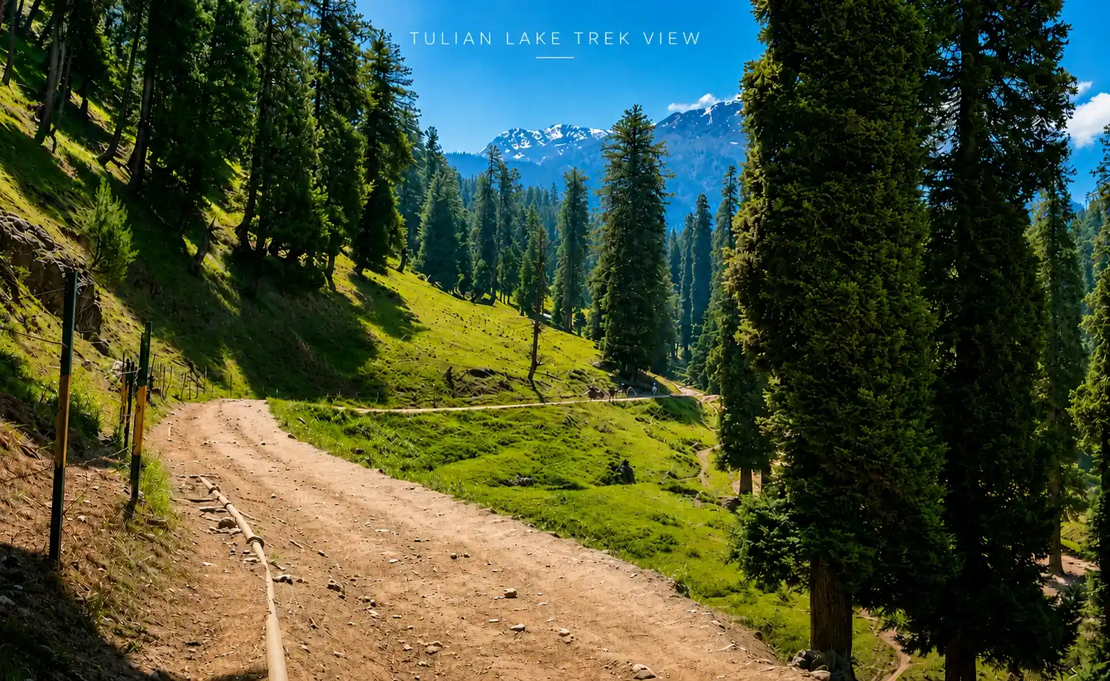
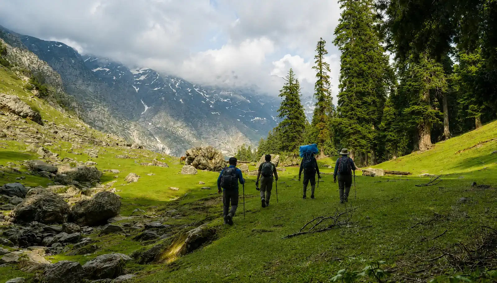
The approach through Pahalgam’s backyard. The trail begins in Ganesh Bal, 2 km from Pahalgam town, and climbs through Baisaran meadows the same rolling grasslands that Kashmir tourism departments call “Mini Switzerland.” Most day-trippers reach Baisaran on ponies and turn back. Trekkers push on into the dense conifer forests above, past shepherd settlements at Kanimool and into Tulian Valley itself. The deeper you go, the fewer people you encounter.
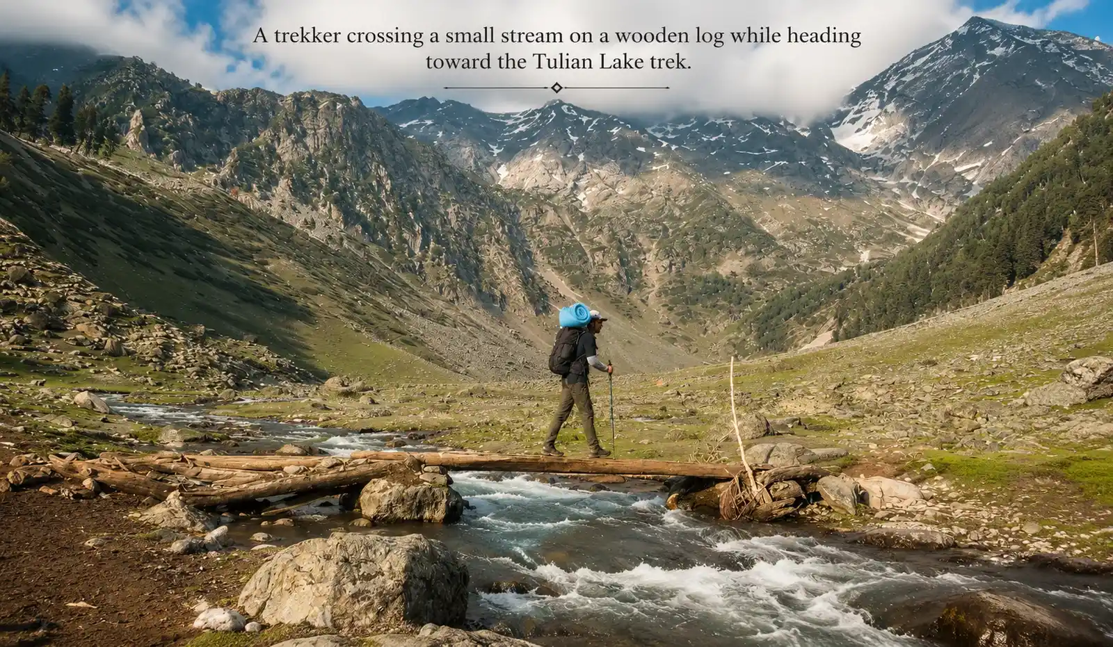
The river that flows from the lake. Somewhere on Day 1, crossing a small stream near Deno Valley, your guide might point out that this water has come directly from Tulian Lake. You’re literally walking upstream toward the source of what you are standing in. It’s a small detail but the kind that makes a trek feel like a story with a destination rather than a route card to be ticked off.
Tulian Lake Trek Overview
The standard Tulian Lake Trek is a 5-day trek running from Srinagar via Pahalgam, ascending through Ganesh Bal → Deno Valley → Kanimool → Tulian Valley → Tulian Lake and returning the same way.
The return path is not a loop. You retrace the route back to Ganesh Bal on Day 5 and drive to Srinagar from there.
Day 1 — Srinagar to Ganesh Bal, Trek to Deno Valley
Drive: Srinagar to Ganesh Bal – 90 km, approximately 2.5 hours
Trek: Ganesh Bal (2,100 m) to Deno Valley (2,516 m)
Distance: 4.5 km trek
Time: 3 hours
Altitude gain: 416 m
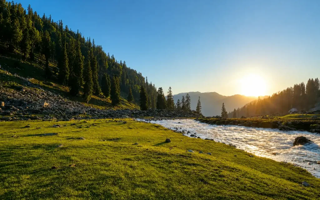
Leave Srinagar in the morning and drive south toward Pahalgam through the Lidder Valley. The road runs alongside the Lidder River one of the better Kashmir road drives before reaching Pahalgam town. Continue 2 km beyond Pahalgam to Ganesh Bal, a small village on the eastern bank of the river. This is your trailhead.
The first day’s trek is designed to ease you in. You will climb through spruce and pine forest, cross a small stream and emerge into the open meadow of Deno Valley (also written Dyan on some maps). The forest here has that particular Pahalgam quality dark, cool, dense, smelling of pine resin. There are dhabas at a clearing mid way where you can stop for chai. The stream you cross is the same one draining down from Tulian Lake above worth noting.
Camp in the meadow at Deno Valley. In clear weather the views up into the valley ahead give you your first look at the ridgeline you will be crossing over the next few days.
Altitude gain: ~416 m
Stay: Camp at Deno Valley (2,516 m)
Day 2 — Deno Valley to Kanimool
Distance: 6.5 km
Time: 5–6 hours
Altitude gain: 381 m
Today’s terrain shifts. The trail climbs back toward the treeline, passes through the meadow clearing of Chutiyaal and enters thicker forest above the Baisaran plateau. This is shepherd country where you will pass seasonal huts where Gujjar-Bakarwal families spend their summer months moving livestock between pastures. In July and August, the hillsides above are dotted with their tents.
The ascent is consistent today no dramatic spikes, but a steady climb that builds over six hours. The forest stretches of this day are the best on the entire trek. Chir, pine, fir and spruce mix in layers and the undergrowth has a lush, almost overgrown quality unusual for Himalayan trekking terrain. Walk slowly here if you can.
Kanimool (2,897 m) is a high-altitude camping ground with views of the Hodasarbal and Wokhalbal peaks to the north. These peaks are not well known by name outside Kashmir but form a striking backdrop. On a clear evening the light off those ridges turns the camp golden around 5 pm.
Altitude gain: 381 m
Stay: Camp at Kanimool (2,897 m)
Day 3 — Kanimool to Tulian Valley
Distance: 4 km
Time: 5 hours
Altitude gain: 324 m
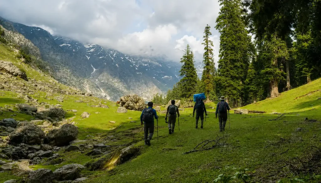
Short in distance but not in effort. Four kilometres of near continuous ascent on a forest floor that, particularly after recent rain, becomes genuinely slippery. Trekking poles are more useful on this day than any other. The trail is well used by shepherds and their horses, which means the surface is churned in places and loses structure.
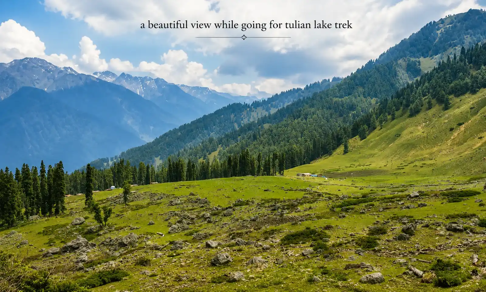
As you climb, the forest gradually thins and the treeline retreats. Above the final tree cover, the valley opens dramatically into Tulian Valley at 3,221 m, a wide, flat basin with a cold stream running through the middle, steep rock faces rising on three sides and the kind of quiet that only comes above the shepherd zone. There’s usually snow on the surrounding ridges even in August. The stony huts visible in the valley are shepherd shelters and in season some families still use them.
This is one of the best campsites on any Kashmir trek. You will spend two nights here.
Altitude gain: 324 m
Stay: Camp at Tulian Valley (3,221 m)
Day 4 — Tulian Valley to Tulian Lake and Return
Distance: 4 km one way (8 km return)
Time: 5–7 hours round trip
Altitude gain: 464 m
This is the day the trek earns its reputation.
The morning starts with a gradual ascent from the valley floor, moving over grassy terrain that feels manageable. Then, around the halfway mark, everything changes. The trail hits a boulder field loose, large, uneven that demands your full attention for the next hour. There’s no path as such through here, just a general upward direction that your guide will know and you will need to trust. Follow their foot placement.
Above the boulders comes the final approach: steep scree and rock faces with no established trail, a 30–40 minute push that requires using your hands in places. This part of the trail is open and exposed (not protected by trees or terrain). During July and August, afternoon clouds often form quickly over Tulian Valley, which can bring rain or even hail. If you are still climbing around noon, weather conditions may worsen. So start early and try to reach Tulian Lake by 10–11 AM.
Then you reach the top and the lake is suddenly just there.
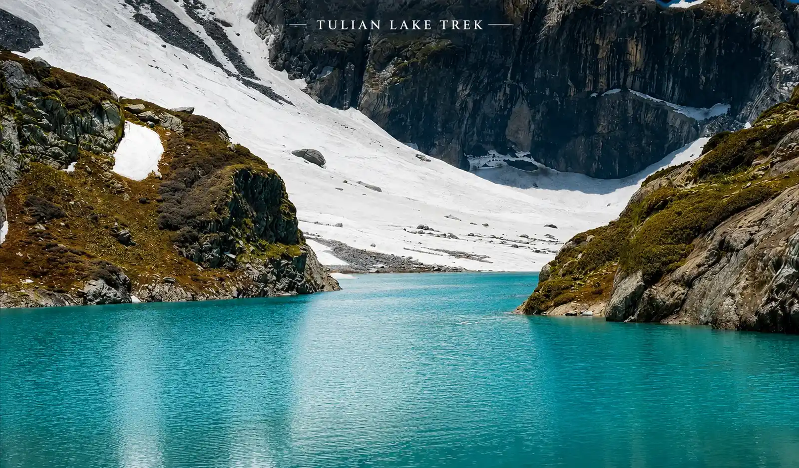
At 3,685 m, Tulian Lake spreads out in its unmistakable figure eight shape. The water is turquoise in the upper lobe, slightly darker in the lower. Ice chunks float in the shallower sections well into summer a strange contrast with the warmth of the ascent you just completed. The surrounding walls are raw granite, snow streaked on the north faces. There is nothing man made anywhere in your field of view.
Spend time here. Have lunch at the lakeside. The descent is not trivial the same scree and boulder field coming down requires just as much concentration as the ascent and this is where most ankle injuries happen. Slow and deliberate is faster in the long run than fast and falling.
Altitude gain/loss: +464 m / -464 m return
Stay: Return to camp at Tulian Valley (3,221 m)
Day 5 — Tulian Valley to Ganesh Bal, Drive to Srinagar
Distance: 10.5 km trek
Time: 5–6 hours
Altitude loss: 1,121 m
The full descent in one day. The route back through Kanimool, the forest sections and down to Ganesh Bal is continuous descent easier on the lungs than the climb up, harder on the knees. Trekking poles earn their weight again on the steep forest section between Kanimool and the Chutiyaal meadow.
You will arrive at Ganesh Bal in the early afternoon, having essentially retraced three days of ascent in one long downward push. From there, a cab to Srinagar takes 2.5 hours. Most trekkers reach Srinagar by evening with enough energy left to eat a proper meal and collapse.
Altitude loss: 1,121 m
Stay: Hotel in Srinagar or Pahalgam
Inclusions and Exclusions
Inclusions
- Meals: Vegetarian and egg-based meals provided from Day 1 evening to Day 8 lunch.
- Permits and Fees: All necessary permits and fees (equivalent to Indian nationals) covered.
- Camping Equipment: Twin-share tents, sleeping bags, and mattresses provided.
- Safety Equipment: Static rescue rope, seat harness, carabiners, and pulleys included.
- Trek Leadership: Certified mountaineering trek leader with first aid and rescue training.
- Local Support: Experienced local guide, cook, and helpers included.
- Luggage Transport: Porters or mules for carrying shared luggage.
- Medical Kit: Exhaustive first aid kit with portable oxygen cylinder.
Exclusions
- Meals: Participants are responsible for meals during road journeys.
- Insurance: Any type of insurance is not covered.
- Personal Expenses: All personal expenses are to be borne by the participant.
- Additional Costs: Any expenses not explicitly mentioned in the package inclusions are not covered.
- Luggage: Participants are responsible for carrying their personal backpacks.
- Transportation: Transportation to and from Srinagar is not included.
Difficulty Level and Who This Trek Is For
The Tulian Lake Trek is listed as easy to moderate by most operators, including Indiahikes and Bikat Adventures. That rating is accurate for Days 1–3 and Day 5. Day 4 is moderate to moderately hard, specifically the boulder and scree section above Tulian Valley to the lake.
The trek is well-suited for:
- First-time or beginner trekkers with decent base fitness
- Families with older children (12+ years) who are comfortable with physical activity
- Anyone wanting a Kashmir alpine experience without committing to a 6–7 day trek like the Kashmir Great Lakes route
- Trekkers who want a proper alpine lake destination without a high-altitude pass crossing
You should prepare properly if:
- You have never walked more than 5–6 km at a stretch start training 4–6 weeks out
- You have knee issues ,the Day 5 descent covers 1,100 m downhill in one stretch
- You are planning this in late September nights at Tulian Valley camp drop well below zero and the Day 4 ascent can have significant snow
This trek is not suitable for:
- People looking for a casual day hike — Day 4 specifically requires altitude preparation
- Groups with young children (under 10) unless they are experienced trekkers
If you want to warm up your trail legs first, the Thajwas Glacier from Sonamarg is an excellent half day option before you commit to the Tulian multi day itinerary.
Best Time to Trek Tulian Lake
The window: June to September. The trail is snow blocked from October or November through May and access to the upper reaches of Tulian Valley is unreliable until the snowpack clears.
June (late): The trail to the lake may still have significant snow patches on the Day 4 ascent. Possible for experienced trekkers with proper footwear. The valley is lush, crowds are minimal. Confirm snow conditions before departure.
July: Peak season. The meadows at Baisaran, Deno Valley and Kanimool are at their greenest. Wildflowers throughout the lower sections. Temperature at Tulian Valley camp sits around 8–14°C during the day, dropping to 3–6°C at night. Day 4’s boulder section is dry and manageable.
August: The busiest month, particularly on the lower sections near Baisaran (popular with day visitors on ponies). Above Kanimool, crowds thin sharply. Afternoon cloud is normal and occasional brief rain or hail above 3,000 m. Still excellent trekking conditions.
September: The best photography month. Light quality improves, skies are clearer after monsoon season, and the crowds have thinned significantly. Nights are cold and at Tulian Valley drops to 0–3°C and the lake area can dip below zero. Sleeping bag quality becomes important. The route is excellent but come prepared for cold.
October onward: Not recommended. First significant snowfall can arrive any time from late September. The trail becomes hazardous above Kanimool.
How to Reach the Starting Point
Starting point: Ganesh Bal village, 2 km from Pahalgam, Anantnag district
From Srinagar: The standard route is Srinagar → Anantnag → Pahalgam → Ganesh Bal. Total distance approximately 90 km, taking 2.5 to 3 hours by road. The Pahalgam road via the Lidder Valley is one of the more scenic drives in Kashmir with well-surfaced and straightforward. Travel My Kashmir Travel Agency arranges direct cab service from Srinagar to Pahalgam as part of trekking packages.
From Pahalgam: Ganesh Bal is 2 km downstream from Pahalgam bazaar, on the eastern bank of the Lidder River. It’s a short auto rickshaw or cab ride. If you are spending a night in Pahalgam before the trek (a good idea), your guesthouse can arrange this transfer for a few hundred rupees.
By air: Fly into Srinagar (SXR). The airport is roughly 3.5 hours from Pahalgam by road. Cab from Srinagar airport to Pahalgam is the most convenient option.
Staying in Pahalgam vs. Srinagar before the trek: Pahalgam has good mid range guesthouses and the advantage of being 2 km from the trailhead. It’s quieter and more pleasant than racing from Srinagar on the morning of Day 1. If your itinerary allows, a night in Pahalgam the evening before is well worth it, you start the trek fresh rather than after a 3-hour drive.
Permits and Entry Formalities
Unlike the Gurez Valley Trek, which requires an Inner Line Permit, the Tulian Lake Trek has no special permit requirements for Indian nationals.
You will need a standard trekking registration at the Pahalgam forest checkpost. Travel My Kashmir handles this as part of the trek package. If trekking independently, carry your government issued photo ID (Aadhaar or passport) and register at the checkpost before entering the trail.
Foreign nationals should carry their passport and Indian visa documentation. Pahalgam is not a restricted area, so standard tourist documentation applies.
What to Pack for Tulian Lake Trek
The Tulian Lake Trek has one cold camp (Tulian Valley, 3,221 m) and one extreme day (Day 4 to the lake). Pack for both.
Layering system that works here:
- Lightweight moisture wicking base layer for trekking (one, washed each evening)
- Warm mid layer fleece or down jacket as Tulian Valley evenings require this, not just the lake
- Waterproof shell because afternoon cloud builds from around 1 pm in August above 3,000 m; carry it in the top of your pack, not your bag
- Full-length trekking trousers, not shorts the boulder section on Day 4 involves hands and knees in places
Footwear reality for Day 4: The scree section above Tulian Valley is loose. Soft-soled trail runners give you no stability on this terrain and every step shifts. Ankle support trekking boots with a stiff rubber sole are not optional on Day 4, they are the difference between a confident ascent and a genuinely risky one.
Things specific to this route:
- Trekking poles — more important here than on many Kashmir treks, specifically for the Day 3 slippery forest descent and the Day 4 scree
- Gaiters — optional in July, genuinely useful in June and late September when snow sits on the Day 4 approach
- Sunscreen for face and hands — the Tulian Valley basin reflects a lot of light; UV exposure is higher than trekkers expect
- Small dry bag inside your main pack for Day 4 — if afternoon rain catches you on the boulder section, wet camp clothes are a miserable reward for the ascent
Leave at the hotel in Srinagar or Pahalgam: Anything above 12 kg total pack weight. Horses carry group equipment (tents, cooking supplies) on this trek, but your personal daypack for Day 4 should be as light as possible. The boulder section humbles heavy packers.
Cash: Pahalgam has ATMs. Above Ganesh Bal there are none. Carry sufficient cash from Pahalgam for any incidentals on trail.
Phone signal: Works well in Pahalgam and Ganesh Bal. Above Deno Valley, Airtel and Jio coverage becomes patchy. At Kanimool and above, expect minimal or no signal. BSNL holds slightly better but not reliably.
Ground Reality — What Most Guides Don’t Mention
Baisaran is a tourist circus. In July and August, the lower meadows of Baisaran (between Ganesh Bal and Deno Valley) are flooded with day visitors on ponies, many of whom ride up for photos and ride back. By mid-morning in peak season, this section can feel like a traffic jam. The solution is simple, start your Day 1 trek before 7 am. By the time the pony parade begins, you will already be well past the Baisaran zone and into the quieter forest above.
Day 4 will take longer than the stated 5–6 hours. Most trekkers without prior high altitude boulder experience take 7–8 hours for the full Day 4 round trip. Build in extra time. Do not rush the descent.
The lake can be windy and cold even in peak season. You will be at 3,685 m in a wide open basin with no tree cover. Bring an extra layer for the time you spend at the lake you won’t want to leave quickly and standing still at altitude in wind cools you fast.
Horses on the trail. The route is a working shepherd and horse track. You will share the lower sections of the trail with loaded horses, often in the narrower forest sections. Give way. Step to the uphill side and stay still. Horses moving downhill with loads in narrow forest paths are not predictable.
The Pahalgam horse-pony operator network. Pony rides are available up to Baisaran and some operators will claim their ponies go all the way to Tulian Lake. They don’t not reliably and not beyond Kanimool in most cases. If you are planning the trek properly, you are walking. Don’t let pony operators at Ganesh Bal reframe your multi-day trek as a pony excursion.
Tulian Lake vs. Other Kashmir Treks: Where It Fits
If you are deciding between Kashmir’s trekking options, here’s honest context:
Tulian Lake vs. Tarsar Marsar: Tulian is shorter, lower and has only one lake destination. Tarsar Marsar involves two distinct lakes, a higher altitude and more dramatic scenery overall. If you can handle 6–7 days, Tarsar Marsar is the more rewarding experience. Tulian is the right choice if you have 5 days and want an authentic alpine lake without the extended commitment.
Tulian Lake vs. Nafran Valley: Nafran Valley also starts from the Pahalgam region and offers meadow-heavy trekking. Nafran is more gradual in ascent, less boulder heavy at the top. Tulian is more dramatic at the destination. They serve different moods.
Tulian Lake vs. Kashmir Great Lakes: No comparison in scope, the Great Lakes Trek covers seven lakes over seven days at higher altitude. Tulian is the right starting point for someone who wants to know whether they’re ready for Kashmir’s big routes. Do Tulian this year, Great Lakes next year.
For a complete look at all difficulty levels and durations, see the Kashmir trekking guide.
Combining the Tulian Lake Trek with a Srinagar houseboat stay and a drive through Pahalgam’s valleys? Travel My Kashmir builds custom Kashmir itineraries around this trek. Get in touch to plan yours.
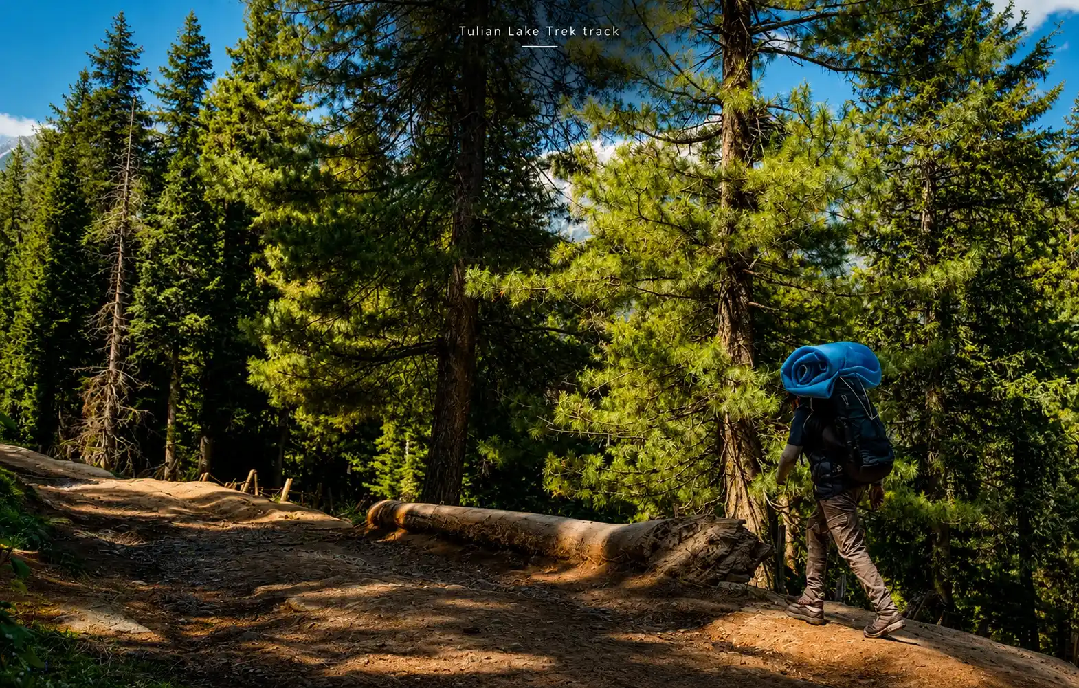
Photos of Tulian Lake Trek


Frequently asked questions
Is Tulian Lake trek suitable for beginners?
Yes, with one important qualifier. Days 1–3 and Day 5 are beginner friendly with moderate fitness. Day 4 — the ascent to the lake is harder than the rest of the trek. If you are a complete beginner, train specifically for uphills and boulder walking before you go. Don’t underestimate the altitude on Day 4.
Can Tulian Lake be done as a day trek from Pahalgam?
Technically possible for very strong, fit trekkers roughly 32 km and 1,600 m altitude gain in one day. Not recommended. The risk of being caught on the boulder section or scree in afternoon weather without overnight shelter is real. The 5-day format exists for good reason.
Is there accommodation on the trail?
Camping only above Ganesh Bal. There are no tea houses, guesthouses or permanent shelters between Ganesh Bal and Tulian Valley. All camping equipment is included in Travel My Kashmir packages.
What is the Tulian Lake trek cost?
Costs vary depending on group size, inclusions and duration. Contact Travel My Kashmir for a current price packages typically include Srinagar cab transfers, Pahalgam cab, all camping equipment, guide, cook and meals on trail.
Does the lake have ice even in summer?
Yes. Ice chunks float on the surface of Tulian Lake well into August and sometimes September, particularly in the shallower northern lobe. The lake does not fully freeze in summer, but residual winter ice persists. This is part of what makes the lake visually striking.
Is Tulian Lake trek safe after the Pahalgam incident of 2025?
Security conditions in the Pahalgam region are regularly reviewed by local authorities and the army. Travel My Kashmir operates only when access is confirmed safe with local intelligence and army clearance. Always confirm current ground conditions at the time of booking. We will not operate this trek if there are active security advisories in the Pahalgam area.
How do I book the Tulian Lake Trek?
Call or WhatsApp Travel My Kashmir at +91 979-646-6052. July and August departure slots fill early. Book at least 3–4 weeks in advance for peak season.