The Great lakes trek in kashmir
The Kashmir great lakes (KGL) trek is a popular , multi day Himalayan expedition that showcases the stunning high altitude alpine lakes and meadows of the Kashmir valley. This trek is considered moderately difficult and requires a good level of physical fitness due to its long daily trekking distances and steep passes.
Table of Contents
ToggleKashmir Great Lakes Trek Overview
- Trek Name: Kashmir Great Lakes
- Trek Duration: 8 days
- Distance : 72 Kms
- Highest Altitude: 13,750 ft
- Country: India
- Location: Kashmir
- Suitable for: 12- 60 years
- Trek Difficulty: Moderate to Difficult
- Base camp: Gagangir
- Month: July | August | September |
- Railway station: Srinagar Railway station
- Airport: Srinagar (sheikh ul-alam international)
Kashmir Great Lakes Trek: Hiking Heaven in the Himalayas
The Kashmir Great Lakes Trek is a high-altitude trek in Kashmir India, covering approximately 75 km over 8 days. It features alpine lakes, meadows, and snow-capped peaks. The trek reaches an altitude of about 13,800 feet and includes challenging ascents and descents. The best time to go is from July to September.
This 8-days journey is situated 75 km northeast of Srinagar and takes you through lush meadows, dense forests, and rocky terrain, showcasing seven stunning high-altitude lakes situated among snow-capped peaks.
During this trek you are going to explore 7 great lakes of Kashmir and five different beautiful valleys. Trekkers will experience diverse flora and fauna, encounter local shepherds, and camp under star-filled skies.
With moderate difficulty, this trek is perfect for both beginners and experienced hikers seeking to immerse themselves in the raw beauty of Kashmir’s wilderness. Buts it’s best to go for short treks before going for this trek. Here you can check short treks in Kashmir.
The best time for Great Lakes trek Kashmir expedition is from July to September when the weather is most favorable and the scenery at its peak. The Kashmir great lakes trek distance is 72 Kms.
4 Groups per month , Minimum 12 , Max 30
The Kashmir Great Lakes Trek is a breathtaking adventure through pristine alpine meadows, crystal-clear lakes, and majestic Himalayan peaks.
The Tarsar Marsar Trek is a scenic journey through lush meadows, sparkling alpine lakes, and the serene beauty of Kashmir’s hidden valleys.
The Naranag Mahlish Trek is an offbeat trail in Kashmir, offering stunning views of alpine meadows, dense forests, and high-altitude lakes.
The Kolahoi Glacier Trek is a thrilling adventure in Kashmir, leading to the majestic Kolahoi Glacier through lush valleys and rugged mountain trails.
The Nafran Valley Trek is a hidden gem in Kashmir, offering breathtaking views of lush meadows, alpine lakes, and snow-capped peaks.
The Thajiwas Glacier Trek is a short, 3-kilometer trek starting from Sonmarg, offering stunning views of snow-capped peaks and lush meadows.
What to Expect
- Explore 7 Great Lakes of Kashmir
- Traverse 5 Distinct and Beautiful Valleys
- Encounter Diverse Flora and Fauna
- Experience Local Shepherd Culture
- Camp Under Star-Filled Skies
Is This Trek Right for You?
With a difficulty level ranging from moderate to challenging, this trek is suitable for both beginners and experienced hikers. We recommend shorter treks like Thajwas glacier trek beforehand to prepare.
Complete itinerary of Kashmir Great Lakes Trek (KGL)
Our aim is to keep trekkers well-informed before starting the Kashmir Great Lakes trek. With good knowledge, you can make your trek safe and risk-free. In this section, you will find detailed information about the Kashmir Great Lakes trek. We have created two itineraries a short itinerary for a quick overview and a detailed itinerary which includes a detailed information for Kashmir great lakes trek. It covers what to expect each day and how to prepare.
A Short and Quick Itinerary of Kashmir Great Lakes
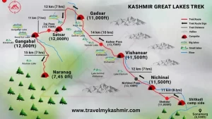
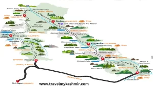
Day 1: Drive from Srinagar to Gagangir.
Drive Duration: 3-4 hours | Drive Distance: 83 km | Pick-up point for Travel My Kashmir trekkers: Kashmir cab service by Travel My Kashmir.
Transportation will be arranged at 10:00 am on Day 2, departing from from Srinagar to Gagangir.
Day 2: Drive from Gagangir to Shitkadi Trek to Nichnai
Trek distance: 11.6 km | Trek duration: 6.5 hours | Altitude gain: 8,150 ft to 11,607 ft
Transportation will be arranged at 10:00 am on Day 2, departing from Gagangir to Shitkadi Base camp.
Day 3: Trek from Nichnai to Vishnusar via Nichnai Pass
Trek distance: 13.5 km | Trek Duration: 7 hours | Altitude gain: 11,607 ft to 12,011 ft via 13,229 ft
Trek Difficulty: Moderate
The journey unfolds in three distinct phases:
- Initial Stage: A gradual uphill trek lasting approximately 90 minutes.
- Middle Phase: An hour-long ascent to reach the mountain pass.
- Final Leg: A challenging hour-long steep descent from the pass, which then transitions into a more comfortable flat terrain walk.
Day 4: Trek from Vishnusar Lake to Gadsar via Gadsar Pass
Trek distance: 16 km | Trek Duration: 7.5 hours | Altitude gain and loss: 12,011 ft to 10,706 ft via 13,715 ft
Trek Difficulty: Moderate to Challenging
The journey consists of three main segments:
- Initial Climb: A rigorous uphill trek lasting between 90 to 120 minutes. This steep ascent forms the most demanding part of the journey.
- Descent Phase: Following the climb, trekkers face a steep downhill section for approximately 60 minutes.
- Final Stretch: The trail levels out, offering a more relaxed walking experience to conclude the trek.
Day 5: Trek from Gadsar to Satsar
Trek distance: 11.5 km | Trek Duration: 4.5 hours | Altitude gain: 10,706 ft to 11,985 ft
Trek Difficulty: Moderate
The journey is composed of two distinct phases:
- Initial Climb: A challenging uphill trek lasting approximately 90 minutes. This steep ascent forms the most demanding portion of the route.
- Plateau Phase: Following the climb, the trail evens out, offering a more comfortable walking experience for the remainder of the trek.
Day 6: Trek from Satsar to Gangabal via Zaj Pass
Trek distance: 9 km | Trek Duration: 6 hours | Altitude loss: 11,985 ft to 11,486 ft via 13,276 ft
Trek Difficulty: Challenging. The trek involves 30 minutes of gradual ascent, followed by a steep climb lasting approximately 45 minutes, and then a steep descent. This pattern of ascending and descending continues throughout the trail.
Day 7: Trek from Gangabal to Naranag. Drive to Srinagar
Trek distance: 13 km | Trek Duration: 6 hours | Altitude loss: 11,486 ft to 7,800 ft Drive Distance: 2 hours | Drive Duration: 50 km
Trek Difficulty: Moderate. The trail features a combination of ascents and descents over 6 km, followed by a very steep descent. You should arrive in Srinagar by 5 pm.
Day 8: Buffer Day
A buffer day in trekking is an extra day built into the itinerary to account for unexpected circumstances or delays.
Detailed Kashmir Great Lakes Trek (KGL) Itinerary
This detailed itinerary provides a comprehensive, day-by-day guide to help you plan and prepare your seven lakes trek Kashmir with confidence. From daily activities and highlights to essential tips, you will have Know everything you need to make the most of your experience.
Day 1
Day 1 : Drive from Srinagar to Gagangir
Drive Duration: 3-4 hours | Drive Distance: 83 km
you will be picked up by our cab service in Srinagar at 10 am. The drive will take around 4 hours to reach Gagangir, which is the basecamp of this trek.
Day 2
Day 2 : Drive from Gagangir to Shitkadi. Trek to Nichnai
Trek distance: 11.6 km | Duration: 6.5 hours
Altitude : 8,150 ft to 11,607 ft
Trek Gradient: Moderate. Expect a steep ascent lasting 3 hours, followed by an hour of descent. The final 2 hours involve a gradual climb to Nichnai.
Journey to Nichnai: A Scenic Trek from Shitkadi
Starting Point: Your adventure begins with a short 30-minute drive to Shitkadi, located 3 km from Sonamarg on the Srinagar road. Look for a solitary dhaba on the right – your last chance for supplies before Naranag.
Trail Overview:
- 3-hour ascent
- 1-hour descent
- 2-hour gentle ascent to Nichnai
The Route:
- Initial Ascent (3 hours):
- Follow the jeep track diverging right, descending to the Sindh river level.
- Trail veers left into a verdant meadow overlooking Sonamarg.
- Ascend through Maple and Pine forests, enjoying unique Kashmiri landscapes.
- Reach a ridge offering panoramic views of Sonamarg valley.
- Descent to Shekdur (1 hour):
- Descend into a picturesque meadow flanked by Silver Birch trees.
- Pass shepherds’ huts and small brooks – ideal for water refills.
- Arrive at Shekdur, a beautiful meadow surrounded by Bhoj trees. Lunch stop.
- Final Stretch to Nichnai (2 hours):
- Trek through Silver Birch forests, enjoying dappled sunlight.
- Descend to a river valley, marking the start of Nichnai.
- Follow the right bank upstream, with views of snow-capped peaks behind.
- The valley widens, revealing expansive green meadows between mountain ranges.
Campsite: Set up camp on flat ground in the wide river valley, with twin snow-clad peaks visible in the distance.
Day 3
Day 3 : Trek from Nichnai to Vishnusar via Nichnai Pass
Trek distance: 13.5 km | Trek Duration: 7 hours
Altitude gain: 11,607 ft to 12,011 ft via 13,229 ft
Trek difficulty :The trek has a moderate gradient. It starts with 1.5 hours of gradual ascent, then an hour of climbing to reach the pass. Afterward, there’s a steep descent from the pass for about an hour, which eventually levels out into a flat walk.
On the 3rd day, we start at 8:00 am, and the first milestone of the day is the Nichnai Pass or Vishnusar Berry, which is visible from the campsite, located just to the right of the twin snow-covered peaks. After walking along the river for about half an hour, cross it to reach the left bank. Follow this bank for the next hour, noting that the trail gradually begins to ascend through the meadow.
The next hour involves a moderate climb to the Nichnai Pass at 13,500 feet, followed by a short descent and a long, flat walk through meadows leading to Vishnusar Lake. As you climb, you’ll spot a deep blue lake at the base of the mountains, which heightens your anticipation for the lake ahead. From the Nichnai Pass, you can view the Sonamarg Valley and the trail you have followed. BSNL phone networks usually work here, and it is also the last point on the trek where you get network coverage; the next opportunity for network is after Gangbal.
The Nichnai Pass resembles a large tunnel and represents a swift ascent by trekking standards, especially since you’re only on the second day of your trek. It is the highest point of today’s trek, located at an altitude of 13,100 feet. From this pass, the trail begins to descend. The descent starts on a rocky path, which then transitions to grassy terrain within the next hour. You’ll notice red flowers blooming around you as you walk through a vast green meadow framed by mountains. A new river flows from the pass into this meadow.
Take a moment to capture these beautiful views. To your left, observe a large waterfall cascading down the mountain and merging with the river. After the waterfall, the rapid descent ends, and you’ll continue through a wide, flat meadow. On the left, you’ll see classic snow-capped Himalayan peaks, while to your right, the grey, barren mountains resemble the Ladakh ranges.
As you walk through the lush green grass between these ranges, you will see two main streams flowing through the valley. Stay close to the left stream and prepare for another icy stream crossing in about half an hour.
Proceed through the meadow for another hour and a half until you reach the valley’s end, where a perpendicular stream flows from left to right. This stream originates from Vishnusar Lake, which is situated higher up and is not visible from the campsite. Set up your tents near the stream from the lake, where there is plenty of space.
If time allows, explore the twin lakes. Vishnusar Lake is 0.5 km to the left and 100 feet above the campsite. Follow the stream without crossing it to reach the lake in about 7 minutes. This is the first lake you will see on this trek, and as we continue the Kashmir Great Lakes trek, you will explore additional lakes later. Tonight, we’ll set up camp near Vishnusar Lake.
Day 4
Day 4 : Trek from Vishnusar to Gadsar
Trek distance: 16 km | Trek Duration: 7.5 hours
Altitude gain and loss: 12,011 ft to 10,706 ft via 13,715 ft
Trek gradient: Moderately difficult: 1.5 to 2 hours of steep ascent followed by 1 hour of steep descent, ending with a flat walk
On the 4th day of our trek, we will head to Kishansar Lake via Gadsar Pass. From the campsite, you will see a thin line traversing the mountainside, which is actually the track you need to follow. After about an hour and a half of climbing, you will reach the top of a ridge. Continue climbing for another 45 minutes, and you will arrive at a spot that offers a breathtaking full view of both Kishansar and Vishnusar Lakes.
The beautiful path continues until you reach the pass. This is the Gadsar Pass, at an altitude of 13,800 feet, and it is the highest point on this trek. The trek involves a steep 2-hour ascent, followed by a steep descent, and then a gentle walk through the meadows. Beyond the Gadsar Pass, a long valley unfolds with 2-3 small lakes in view. In the far distance, a series of snow-covered peaks can be seen, located outside our Line of Control.
The descent is straightforward. The first small lake on the left is Yamsar Lake, which is not as popular as the other lakes and is associated with Lord Yama, according to locals. Beyond Yamsar is another unnamed lake. After an hour of descending, you reach flat meadows again. This valley is narrow, with mountains surrounding it on either side. Notice the colorful flowers sprouting from the green grass, starting with red and transitioning to blue and purple iris flowers.
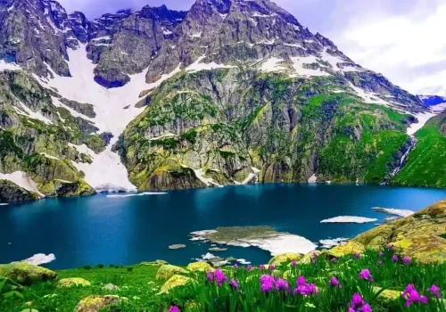
When you reach the area with blue irises, you are near Gadsar Lake, at an altitude of 12,000 feet, one of the most beautiful and untouched lakes on this trek. Located at the base of towering snow-covered peaks, one side of the lake is adorned with snow blocks cascading down from the mountains, while the other side is graced with colorful flowers and lush greenery, creating a mesmerizing view. From Gadsar Lake, you will see a mesmerizing view of Yamsar Lake, the unknown lake, and Gadsar Lake, all connected by a stream of water that flows from the higher lake to the lower.
You can camp at Gadsar Lake, but it is usually preferred to stay near the Gadsar army camp. Continue descending from Gadsar, and within half an hour, the valley opens up. You’ll notice another blue lake on the left side of the valley. As you continue, you will lose a considerable amount of altitude. As you follow the trail, you will start noticing shepherds’ huts, and after another half an hour, you will arrive at the army camp. To move forward, you need permission from the Gadsar army camp. Report to the army post as quickly as possible, as it takes about 2 to 3 hours for the green signal to come through from the headquarters. Your ID proofs will be checked, collected, and recorded before you can proceed further.
Day 5
Day 5 : Trek from Gadsar to Satsar
Trek distance: 11.5 km | Trek Duration: 4.5 hours
Altitude gain: 10,706 ft to 11,985 ft
Trek gradient: Moderate; 1.5 hours of steep ascent followed by a level walk.
From the army camp, you need to move left towards the stream to head up into the mountains. You are now above the tree line, with views of the tree cover and rivers below. The climb continues for an hour and a half, during which you gain 1,100 feet in altitude. After crossing the 11,500-foot mark, the climb transitions into a traverse and bends to the left, leaving the river valley. Once out of the valley, you will walk across a flat meadow surrounded by mountains on all sides. This section of the trail is called Maegandob, where you may also spot a few craters to your right. Soon, you will see the first of the Satsar Lakes. The name Satsar comes from ‘Sat,’ meaning seven, and ‘Sar,’ meaning lake. Satsar is a collection of seven lakes, which perfectly explains the significance of the name.
You can choose to camp at this site if you camped at Gadsar Lake. If you started from the Gadsar army camp, you can cover a little more distance today and camp near the first of the Satsar Lakes. Depending on the season, you may find 4 or 5 of the lakes filled with water. After crossing the bridge, you will come across another army check post, the third check post of this trek. The process here is similar to the Gadsar army camp, involving checking and recording your ID and information. Once the procedures are complete, you can continue on your trail. After walking for 10 minutes, you will reach the first of the Satsar Lakes. The lake is situated in a scenic landscape, surrounded by lush greenery and mountain vistas. Its emerald-blue waters shift in color over time.
Day 6
Day 6 : Trek from Satsar to Gangabal via Zaj Pass
Trek distance: 9 km | Trek Duration: 6 hours
Altitude loss: 11,985 ft to 11,486 ft via 13,276 ft
Trek difficulty: Challenging. It starts with 30 minutes of gradual ascent and descent, followed by a steep 45-minute climb and then a steep descent. The trail continues with alternating ascents and descents throughout.
The trail goes up and down. Starting from our campsite, we will trek for half an hour to reach the largest and last of the Satsar Lakes. The path is mostly rocky with many boulders. After the lake, the trail descends for another half hour until we reach the first forest line. To the right is a ridge, and to the left is the forest. From here, we will climb up a zigzag path to the top of the first ridge. We need to climb two more ridges to reach the top. The terrain is barren and rocky. On the other side, you can see some Gujjar huts and greenery, which contrasts with the rocky trail.
After about a two-hour climb, you’ll reach the top of the third ridge, which is around 13,000 feet high. From there, you can see two lakes with a stream flowing from the higher lake to the lower one, creating a beautiful view. If you look closely, you’ll notice two more lakes on either side. The smaller lake’s name is unknown, but the largest lake is Gangabal, accompanied by Nandkol. The path then goes down and up again as you descend about 1,400 feet to the lake. Now our next destination is either Gangabal or Nandkol. Fill your empty water bottles and move to the next destination.
After walking an hour and a half, you will reach a meadow again. After crossing the wooden bridge on a stream, you will arrive at Nandkol, which is a camping site for the night. The Nandkol lake lies at the base of the Harmukh peak. Both Nandkol and Gadsar are famous for trout fishing. But unfortunately, many people who come here leave behind a lot of waste.
From Nandkol, the Gangbal lake is just a distance of 20 minutes; a stream connects both of them. To reach another lake, we have to cross this stream. Avoid crossing the stream at the lower levels. Instead, head to the bank of Gangabal, where you’ll find a sturdy man-made bridge on the right. Gangbal is a huge lake, and if you want to circle it, then you need at least one hour of time
Day 7
Day 7 : Trek from Gangabal to Naranag and Drive back to Srinagar
Trek distance: 13 km | Trek Duration: 6 hours
Drive Distance: 2 hours | Drive Duration: 50 km
Altitude loss: 11,486 ft to 7,800 ft
Trek gradient: Moderate. A mix of ascents and descents for 6 km followed by a very steep descent all the way down.
Today’s trek is entirely downhill, but the steep descent can be tough on your knees, so be ready. From the Gangabal campsite, follow the stream down through the ridge towards the trees. After about 30 minutes, you will get Airtel network coverage and can let your family know you are alive!. When the ridge ends, you will reach a flat meadow. From here, you can look back and admire the majestic Harmukh Peak.
About an hour into the trek, you’ll enter a forest of mostly pine trees and start seeing signs of civilization, like a log hut. For the next 6 km, you’ll weave in and out of the forest without losing much altitude. After covering two-thirds of the distance, the trail begins a steep descent. This part of the trail is muddy and well-trodden, surrounded by thick pine trees. The last 4 km involve a significant drop of over 3,000 feet. You might see other trekkers heading from Naranang to Gangabal. As Naranang comes into view, there’s a bit more to go. The final stretch is quite steep and can test your endurance. Soon, you’ll reach a stone-paved path and enter the village of Naranang. From there, you’ll drive to Srinagar, expecting to arrive by 6:30 pm. You can then arrange your further travel plans
Day 8
Day 8 : Buffer Day
When planning your Kashmir great lakes trek, always add an extra day to handle any bad weather or political issues that might come up during the trek. This will vary based on the specific trek and the current situation in Kashmir.
KGL Inclusion / Exclusion
Inclusions
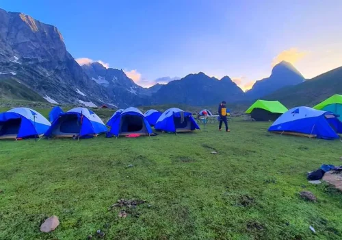
- Accommodation: Tented campsites throughout the trek.
- Meals: Vegetarian and egg-based meals provided from Day 1 evening to Day 8 lunch.
- Permits and Fees: All necessary permits and fees (equivalent to Indian nationals) covered.
- Camping Equipment: Twin-share tents, sleeping bags, and mattresses provided.
- Safety Equipment: Static rescue rope, seat harness, carabiners, and pulleys included.
- Trek Leadership: Certified mountaineering trek leader with first aid and rescue training.
- Local Support: Experienced local guide, cook, and helpers included.
- Luggage Transport: Porters or mules for carrying shared luggage.
- Medical Kit: Exhaustive first aid kit with portable oxygen cylinder.
Exclusions
- Meals: Participants are responsible for meals during road journeys.
- Insurance: Any type of insurance is not covered.
- Personal Expenses: All personal expenses are to be borne by the participant.
- Additional Costs: Any expenses not explicitly mentioned in the package inclusions are not covered.
- Luggage: Participants are responsible for carrying their personal backpacks.
- Transportation: Transportation to and from Srinagar is not included.
Who can participate in the great lakes trek kashmir
Anyone with good physical fitness and prior trekking experience can participate in the Kashmir Great Lakes (KGL) Trek. However, since it’s a moderate to difficult trek, there are certain eligibility criteria:
- Age Requirement: Above 12 years (depending on fitness level). Some organizers set a minimum age of 14-16 years.
- Fitness Level: Should be able to walk 6 km in 35 minutes with ease.
- Stamina & Endurance: Should be comfortable carrying a 12-16 kg backpack while trekking for 6-8 hours daily.
- Experience: Prior trekking experience (at least one high-altitude trek above 10,000 ft) is recommended but not mandatory.
Who Should Avoid It?
- People with Respiratory Issues (like Asthma, severe Bronchitis).
- Heart Patients (as the trek reaches elevations of 13,750 ft).
- Individuals with Severe Knee/Joint Problems (due to steep ascents & descents).
- Those Unprepared for Harsh Weather Conditions (cold temperatures & unpredictable rain).
Group Sizes and Scheduling
- Monthly Trek Groups: We organize 4 groups each month, ensuring personalized attention and a better trekking experience.
- Participant Capacity: Each group accommodates a minimum of 12 trekkers and can host a maximum of 30 participants. This allows for a balanced experience where trekkers can connect with nature and fellow adventurers.
How difficult is the Kashmir Great lakes Trek (KGL)?
The Kashmir great lakes trek is a moderate to difficult trek. During this Grek Lakes trek Kashmir, You will cover a total distance of 75 km over six days, with average of 12 km of trekking each day. The trek involves climbing and descending 1500 feet daily.
The Kashmir great lakes trek reaches its peak altitude at 13,715 feet. Along the way, you will encounter numerous streams to cross and boulders to navigate. There is also a 40 minute long boulder section between Satsar to Gangbal which can be challenging for some trekkers.
Here are some key points about its difficulty:
- Altitude: The trek reaches elevations of around 13,715 feet (3,965 meters), which can cause altitude sickness for some trekkers.
- Terrain: The trail includes steep ascents and descents, rocky paths, and sometimes snow-covered areas depending on the season.
- Duration: It typically takes 6-7 days to complete, covering approximately 70-75 kilometers.
- Weather: Conditions can be unpredictable, with potential for rain, snow, and cold temperatures even in summer.
- Physical fitness: A good level of fitness is required due to long daily walking distances (about 10-15 km per day) and challenging terrain.
- Remoteness: The trek takes place in a relatively isolated area, which can add to the challenge.
How Long is the Kashmir Great Lakes Trek?
The Kashmir Great Lakes Trek takes around 6 to 7 days to complete. During this time, trekkers cover a total distance of approximately 70 to 75 kilometers. The trek is usually done at a moderate pace, allowing time for acclimatization to the high altitude and for enjoying the scenic6 beauty of the region.
Also check : Other famous treks in Kashmir
How Much Does the Kashmir Great Lake Trek (KGL) cost?
For the year 2026 the cost of the Kashmir Great Lakes trek is approximately Rs. 17,000 per person. For more information and inquiries, you can contact Travel My Kashmir at 9796466052 or 7006580880. You should be aware that the Kashmir Great Lakes trek (KGL) is only allowed from July to September.
Kashmir Great Lakes trek permit?
All necessary permits for the Kashmir Great Lakes trek, including Forest Permits, Camping Charges, Trek Permit Fees, and IMF Permission, will be included in our trekking packages. So you don’t have to worry about obtaining any permits yourself. Simply book your KGL trekking package from Travel My Kashmir and start your adventure.
How many lakes are there in the Great Lakes Trek of Kashmir?
The Kashmir Great Lakes Trek includes a total of seven Alpine lakes. These lakes offer breathtaking views and a unique trekking experience. The seven lakes included in the trek are:
- Vishansar Lake
- Kishanganga Lake
- Gadsar Lake
- Satsar Lake
- Kukusar Lake
- Gangabal Lake
- Nundkol Lake
Best Time to Do the Kashmir Great Lakes Trek
The best time for Kashmir Great Lakes trek is from July to September, when the weather is mild, trails are open and the meadows are in full bloom. During this period daytime temperatures range between 15–20°C while nights can drop to 7–10°C. This makes it a comfortable season for trekkers to enjoy the beauty of the valley without facing extremely harsh conditions. By July the snow at higher campsites melts and the valleys transform into colorful flower fields making the trek truly magical.
In June and early July the region receives more rainfall which can make the trek challenging due to wet and slippery terrain. While August and September offer clearer skies and sunnier weather although the nights may be cooler.
The trekking routes are usually crowded from July to August and accommodation prices are higher due to peak demand. For those who prefer fewer crowds and more affordable stays, June and September are better choices while July and August remain the peak trekking season.
- Weather: During the summer months the temperatures are milder and more comfortable for trekking at high altitudes.
- Snow melt: By July month most of the snow on the trails has melted thus making the paths more accessible and safer.
- Landscape: The alpine meadows from mid July are in full bloom creating a vibrant and picturesque views.
- Lake views: During the months of July and September the alpine lakes are usually free from ice, showcasing their crystal clear waters and stunning reflections.
- Stable conditions: This period generally has more stable weather reducing the risk of heavy rains or snowfall that could make the trek difficult.
Note: Even during this period the weather in the mountains can be unpredictable. Trekkers should always be prepared for sudden changes in conditions. Additionally, August can be slightly more crowded due to peak tourist season. If you prefer a quieter experience, you might opt for early July or September.
How to reach the Base camp?
Before going for the Kashmir great Lakes trek , you should be aware of the travel plan. Here we provide step-by-step guide of how to reach the base camp and how to plan your travel of Kashmir great Lakes trek (KGL).
- Fly or travel to Srinagar, the capital city of Jammu and Kashmir.
- From Srinagar, you need to travel to Sonamarg, which is usually the starting point for the trek. This is about 80 km from Srinagar and takes around 2-3 hours by road. We provide the transportation service from Srinagar to the base camp.
- It is always best to keep a buffer day. If your trek is completed on time, you can utilize this buffer day for local sightseeing in Srinagar and can enjoy activities like Shikara ride in Dal lake.
Options to reach Srinagar:
- Direct flight: Srinagar Airport has excellent connectivity with major airports across India. You can also choose our Srinagar airport cab service for a comfortable journey.
- By Railway: If you are arriving by train, the nearest railway station is Srinagar Railway Station. The railway section between Jammu and Srinagar is not fully connected, so you may need to hire a cab from Jammu to Sangaldan Railway Station. From there, you can proceed directly to Srinagar Railway Station. For a hassle-free journey, consider our Srinagar Railway Station cab service.
- By Road: If you are traveling by road, there are multiple options to reach Srinagar, such as a private cab, a bus, a shared cab, tempo travelers, or even you can pre-book a cab from Jammu to Srinagar online.
- Drop-off Information: The specified location for drop-off is Srinagar, at 6 pm.
What to pack for Great Lakes Kashmir Trek?
| Category | Items |
|---|---|
| Clothing | Quick-dry T-shirts, Long-sleeve shirts, Fleece jacket, Down jacket, Trekking pants, Thermal underwear, Rain jacket and pants, Warm hat and gloves, Sun hat or cap, Socks (woolen or synthetic) |
| Footwear | Trekking boots (sturdy and waterproof), Camp shoes or sandals |
| Gear and Equipment | Backpack (40-60 liters, with rain cover), Sleeping bag (suitable for cold temperatures), Sleeping pad or mat, Trekking poles, Headlamp or flashlight, Water bottles or hydration system, Personal first-aid kit, Sunscreen and lip balm, Sunglasses |
| Miscellaneous | Toiletries (including biodegradable soap, hand sanitizer, wet wipes), Towel (quick-dry), Snacks (energy bars, nuts, dried fruits), Personal identification and permits (in waterproof pouch), Camera (with extra batteries or power bank) |
| Optional | Gaiters, Portable charger, Books or entertainment, Trekking umbrella |
Documents required for Great lakes of Kashmir trek or kGL Trek?
Here is the list of documents you must carry with you when starting the Kashmir Great Lakes trek.
- Identification Proof: Carry a valid government-issued ID proof such as Aadhar Card, Passport, Voter ID, or Driving License. This is essential for any identification checks during the trek. Keep both the original as well as photocopy of it.
- Medical certificate: The forest department requires a medical certificate completed by an MBBS doctor to grant permission for your trek. Without this certificate, you won’t be able to obtain the necessary permits. Download Medical certificate
How to get fit for Kashmir Great Lakes?
The Kashmir Great Lakes trek is a beautiful but challenging adventure, so it is important to be well-prepared physically. Here are some tips to help you get fit for the trek:
1. Cardiovascular Endurance
- Running or Jogging: Start with short distances and gradually increase your mileage over time. Aim for at least 30-45 minutes of running or jogging, 3-4 times a week.
- Cycling: Incorporate cycling into your routine to build leg strength and cardiovascular fitness. Aim for longer rides as your fitness improves.
2. Strength Training:
- Leg Exercises: Focus on squats, lunges, and step-ups to build strength in your quadriceps, hamstrings, and calves.
- Core Exercises: Planks, sit-ups, and other core exercises will help you maintain balance and stability on uneven terrain.
3. Stamina Building:
- Long Walks: Try to walk 5-6 kilometers daily, preferably on inclines or uneven terrain to simulate trekking conditions.
- Day Hikes: Go on day hikes with a backpack to get used to carrying weight and walking for extended periods.
Major attractions on the way
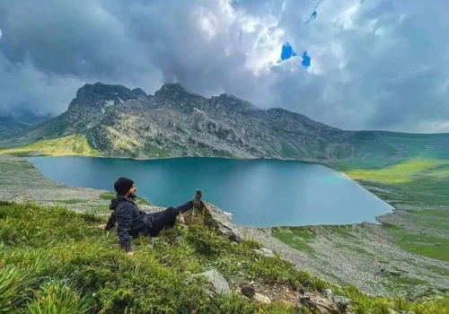
- Alpine lakes: The trek features breathtaking views of several high altitude lakes, including Vishansar, Kishansar, Gadsar, the Satsar Lakes and the twin lakes of Nundkol and Gangabal.
- High altitude passes: Trekkers cross three major passes: Nichnai Pass, Gadsar Pass, and Zaj Pass, each offering unique and dramatic panoramic views.
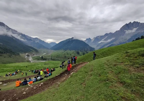
- Meadows and scenery: The trail passes through extensive meadows and valleys blanketed with wildflowers during peak season.
- Mount Harmukh: The sacred peak of Mount Harmukh overlooks the Gangabal and Nundkol lakes
About Mobile Network connectivity during KGL
You will have decent network coverage in Srinagar and up to the starting point at Sonmarg. However, once you begin the trek, the signal becomes unreliable, and most sections of the trail have no mobile connectivity. The last point where you can get BSNL Networks is usually the Nichnai Pass, beyond that, there is no reliable mobile signals.
It’s advisable to inform your family and friends in advance about the limited connectivity and avoid relying on mobile phones during the trek.
For emergencies, trek organizers usually carry satellite phones or radios for communication.
Important Guidelines and Tips for a Safe and Hassle-Free Trek
- Allow your body time to adapt to high altitudes, as weather conditions differ significantly from lower regions.
- Follow instructions provided by your trek leaders or guides to ensure a safe and enjoyable journey.
- Bring basic medications and a first-aid kit to handle minor health issues during the trek.
- Carry a valid ID proof for verification purposes.
- Keep your luggage minimum to avoid any difficulty during the trek.
- Personal expenses, meals not included in the package, and items of personal nature will be at your own cost.
- Mobile and laptop charging points may or may not be available at campsites, and if provided, they will be at a shared location.
- Avoid using plastic bags to help preserve the natural environment and maintain ecological balance.
- Pack warm clothing and bring suitable trekking shoes to stay comfortable and protected.
- In case of emergencies or natural calamities, the management may alter the trek itinerary. However, any changes due to factors beyond control are not included in the package cost.
Things To Carry for Kashmir Great Lakes Trek
- Hiking shoes
- Warm clothes
- Back pack
- Day pack
- Water bottle
- Caps
- Extra pair of socks
- Walking stick
- Rain cover
- Head torch
Is Kashmir Great Lakes crowded?
The Great Lakes Trek Kashmir is gaining popularity and attracting more trekkers. The month of August can be more crowded. So for a quieter experience, it’s best to go in early July or September and avoid weekends.
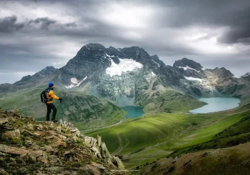
Kashmir Great Lakes Trek Photos?
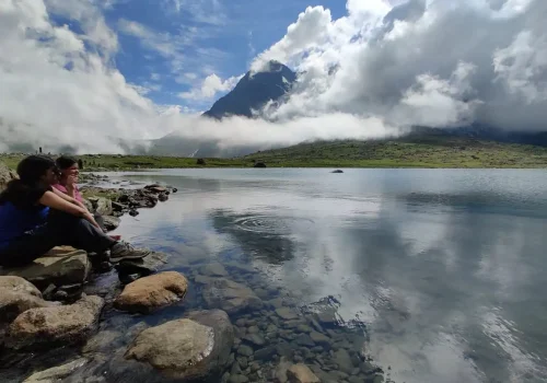
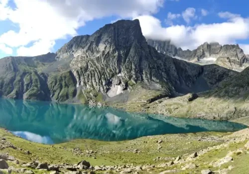
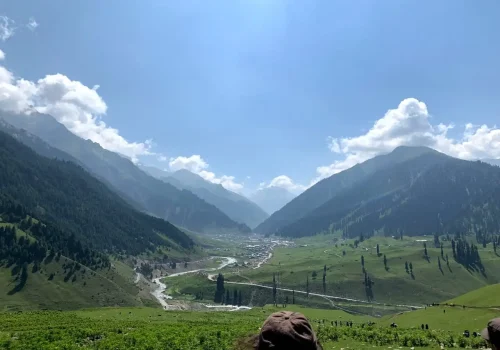
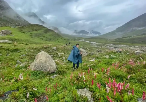
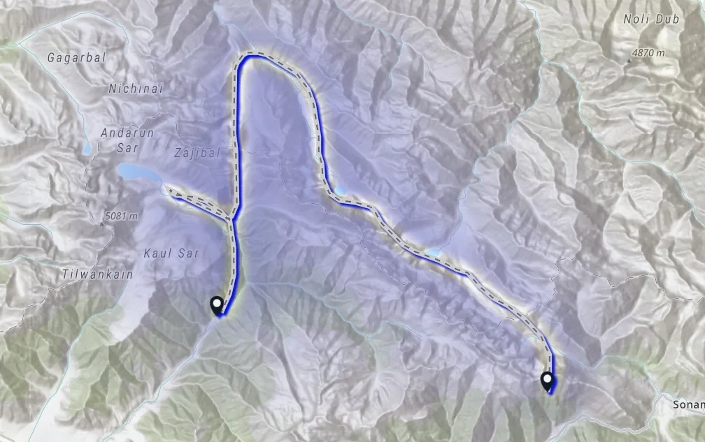
kashmir great lakes trek map
Trusted by Google and Trip Advisor
Check out the reviews from Trip Advisor and Google

Rate Us on Trip Advisor
816+ reviews with ⭐⭐⭐⭐⭐Rating

Rate Us on Google
1500+ reviews with ⭐⭐⭐⭐⭐ Rating
Frequently asked questions
Eligibility Criteria for Kashmir Great Lakes Trek
- Capability to complete a 5 km run in 32 minutes
- BMI below 28
- Children should be at least 12 years old, and adults up to 62 years are recommended
- Commitment to abstain from smoking and drinking during the entire trek
- Dedication to practicing responsible trekking
What is the maximum age for trekking?
There is no maximum age restriction for trekking in India. However, it is recommended that children be at least over 10 years old.
Which month is best for trekking?
The months from July to August are best for Great Lakes trek Kashmir.
Which season is best for Kashmir Great Lakes?
The best season for the Kashmir Great Lakes Trek (KGL Trek) is during the summer months, from July to mid-September.
How long is the Kashmir great lakes trek?
The Kashmir Great Lakes Trek (KGL Trek) is roughly between 69 and 75 kilometers (43 and 47 miles) long. The total distance may vary slightly depending on the specific route chosen by your trekking company. The trek typically takes 7 to 9 days to complete, depending on the pace and itinerary.
How much does the Kashmir Great Lakes Trek cost?
The Kashmir great lakes trek cost starts from Rs. 17000 per person.
What is the fitness level required for Kashmir Great Lakes trek?
The climber needs to be in good physical condition and have the endurance to walk 6 kilometers in 35 minutes without feeling strained. Additionally, they should be capable of carrying a backpack weighing between 12 to 16 kilograms.
Is the Kashmir Great Lakes trek Safe?
The Kashmir Great Lakes Trek (KGL Trek) is generally considered safe for well-prepared trekkers. And with our professional guide you will not face any difficulty during the trek.
What is the difficulty level of Great Lakes of Kashmir Trek?
The Kashmir Great Lakes Trek (KGL Trek) is rated as moderate to difficult.
Should i book the Kashmir great lakes trek in advance?
Yes, booking the Kashmir Great Lakes Trek in advance is highly recommended. This ensures that you secure your spot with a reputable trekking company or organizer. Additionally, it allows you to plan your travel arrangements, obtain necessary permits, and ensure availability of accommodation along the trekking route. Advance booking also gives you time to prepare physically and mentally for the trek, ensuring a smoother and more enjoyable experience overall.
What is the maximum altitude of Kashmir Great Lakes trek?
The maximum altitude of the Kashmir Great Lakes Trek is 13,800 feet at the Gadsar Pass. This is the highest point you will reach during the trek, offering stunning views of the surrounding peaks and lakes

